Day 176 – August 30 – 15.2 miles – Long Pond Lean-to to West Branch Pleasant River Campsite
Elevation Change: 8330 feet
It was around 40 degrees out when we woke up this morning. Great sleeping weather. Not so great getting-out-of-the-sleeping-bag weather. As we were now north of the latitude of Ottawa Canada, and by the end of the day Montreal, some colder weather was to be expected.
We had started our trek in Georgia, and now we were north of some major Canadian Cities. I still can’t wrap my head around it.
We would be going over the Chairback Mountain Range today. It was one of the last mountain ranges left on the trail.
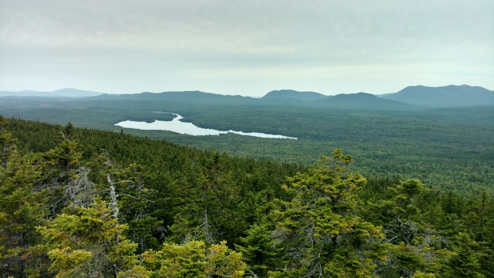
Our day started out with a 1000 foot climb up to the top of Barren Slide.
When we got to the top, we found out why it was called a slide. There was a large sloped smooth rocky area that ended in a cliff. If it was raining I don’t think we would have walked out on it.
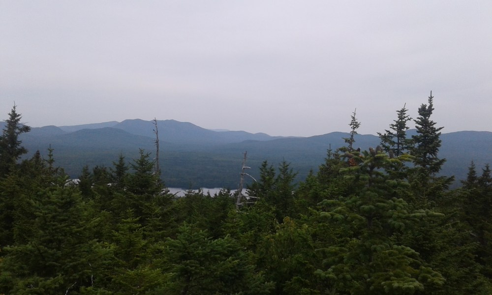
From the slide, we had a great view of the lake below.

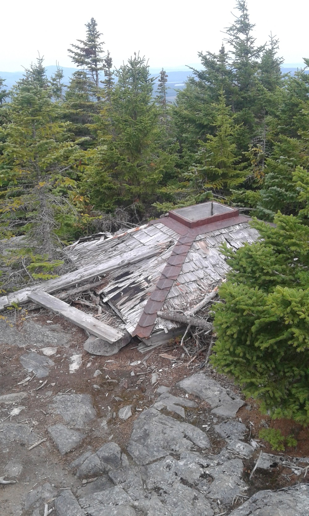
Two miles later, on the top of Barren Mountain, we came to what was left of an abandoned fire tower.
The guidebook stated that the tower wasn’t safe for climbing. Stoat and I decided to see if that was true or not.
Stoat went up first, and got some great pictures.
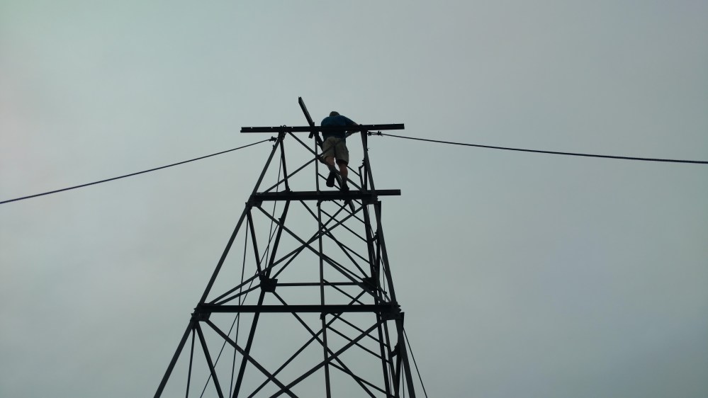
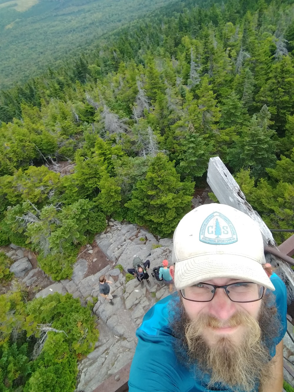

The tower held up to my weight just fine as well. It might have not been the smartest thing to do, but it was a lot of fun.
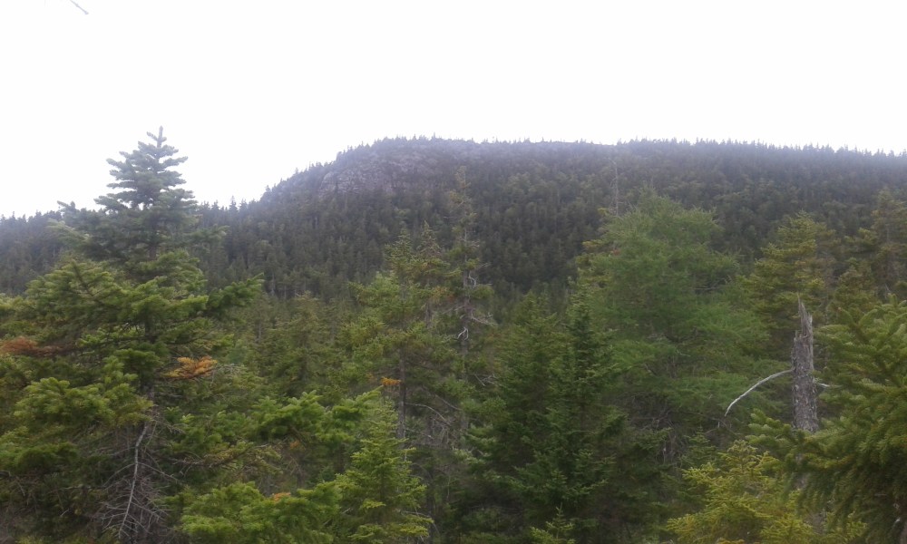
From Barren mountain, we went over the Chairback Mountains. The mountains were named Fourth Mt., Mt. Three and a Half (not kidding), Third Mt., Columbus Mt., and Chairback Mountain.
As we went over the mountains, the trail brought us through varying terrain. Every once and a while we would get a view off into the distance.


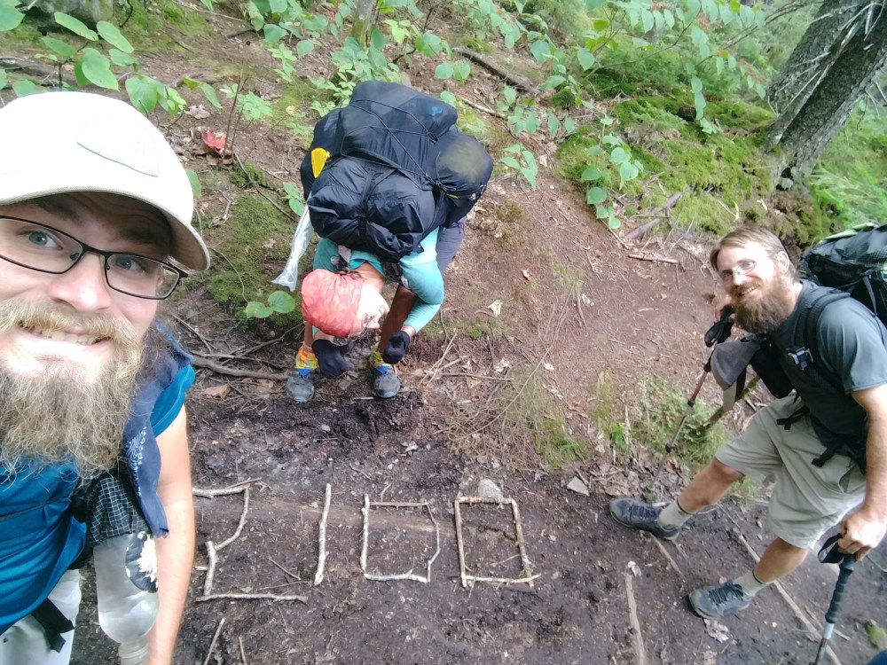
Somewhere between Columbus Mt. and Chairback Mt. we came to the last mile marker. 2100 miles.
I can remember standing at the fire tower on top of Albert Mountain in North Carolina. At the time Stoat and I felt so accomplished. Now, 2000 miles later, Stoat and I felt very accomplished, but not 2000 times or even 21 times more accomplished. One hundred miles is something I can visualize in my brain. 2100 miles is too much to comprehend. It almost doesn’t feel real.

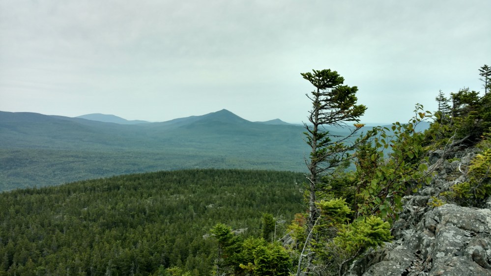
As we approached the summit of Chairback Mountain, the trail brought us along a flat rocky outcropping. From there, we could see the group of mountains we would be going over tomorrow.
When we got there we bumped into a father / son section hiking team that we met on our second day in Maine. As we were walking with and talking to them, a hiker took a moment to enjoy the view and then passed us. We would find out later that day, that the hikers name was Stringbean. Stringbean was attempting to break the unsupported Fastest Known Time record. He was on pace to not only break the unsupported (no outside help) record, but break the supported (with outside help) record as well.
At the time he passed us, Zeus and Flashfire were ahead of Stoat and I. They stopped at a water source to refill their water, and Stringbean walked up. He answered a few questions from Zeus while quickly refilling his water and then headed off down the trail.
Coming down from Chairback Mt. was a little harder than expected. To get down, we had to make our way through a very steep rock slide positioned on the side of a cliff. It was a slow and tedious process to get down.
After descending Chairback, it was a four mile hike to the camping spot. There was a 1000 foot descent in the last 1.8 miles. By the time we reached the camping spot, everyone’s knees were hurting.
The camping spot was located near the confluence of the Henderson Brook and the West Branch Pleasant River. It was a popular spot, with many places to camp, and many campers. We chose a spot near a tent that wasn’t occupied at the time.
A while later the Father / Son Section Hikers walked into camp. The unoccupied tent was theirs! We spent the rest on the evening hanging out with them and lounging around camp.
Tomorrow we may get out first glimpse of Mt. Katahdin!
84.2 miles to go.
____________________________
