Day 144 – July 29 – 17.3 miles – Moose Mountain Shelter to North Jacob Brook Stealth Camp
Elevation Change: 10,312 feet
The day started off with a 1300 foot descent, directly followed by a 1000 foot climb to Holts Ledge. That would wind up being the theme of the day. Today, at least, we had some views.

After going over Holts Ledge, we descended 1100 feet.
The streams and rivers all had crystal clear water. Even though we had enough water, we were tempted to stop to get “fresher” water.


After about 1.5 miles hiking in the lowlands, we came to a concrete mile marker.

The mileage marker wasn’t accurate any longer. Re-routes had caused the trail to grow. We actually had 422.9 miles to Katahdin from the mile post. Either way the mile marker made us feel like we were getting close. Its funny, in “real life” hiking 422 miles would sound like a ridiculous amount. Out on the trail, it felt like we were almost there.
After leaving the milepost, we began our 2120 foot climb up to Smart Mountain.
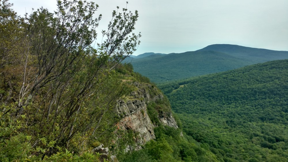
After only a little bit, we came to a place called Lambert Ridge. From there, we had a great view of Smart Mountain. Stoat and I decided to take a snack break there. As we were eating, Salty Camel showed up. When he saw the view he said, “F that’s a lot of trees.” Well… he wasn’t wrong.
Throughout the day we had seen several hikers that we either hadn’t seen in a while, or never seen before. Every time we left a town it seems the “hiker deck” shuffled. It was good to see Salty Camel. He was the only person around that we had met before we got sick.


The trail going up to the top was rougher than the guidebook let on. We began saying that Smarts mountain kinda smarts.
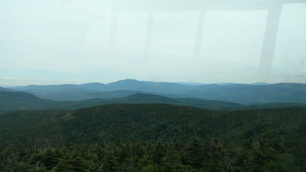
At the top there was a fire tower so, of course, we had to check out the view.
It was a little hazy out, but we could still make out some of the mountains of the Whites
After leaving the fire tower, we began our 1780 foot decent to South Jacob River.
Once we got to South Jacob river, we climbed 400 feet to the Eastman Ledges.


After the Eastman Ledges, we had a quick up and over a small hill and came to North Jacob River. The Hexacube shelter was only 0.4 miles away, but we got word that the shelter was full and there was very little camping options. Seeing that after 0.4 miles on the AT, the shelter was another 0.3 up a steel incline, we decided to find a stealth spot near the river.
Several other hiker had the same idea, so a little tent community sprung up.
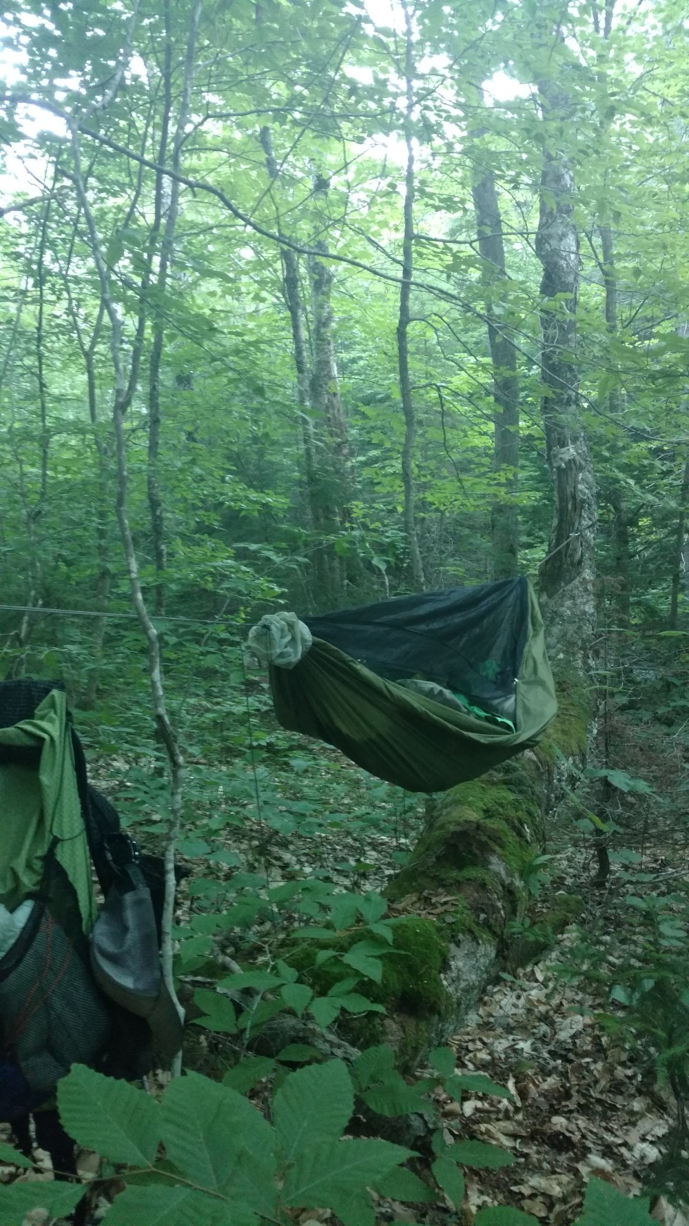
As hammock campers, Stoat and I try to avoid hanging over level ground. We try to leave those spots for tent campers. One thing I like about hammock camping is that it allows you to get a little creative when picking a spot to sleep.
After looking around for a little bit, I saw a large tree that grew horizontally along the ground for about 20 feet before rising skywards. There was another tree inline with the bent tree, at what looked like the perfect spacing to hang a hammock.
When my hammock was hung, the whole scene looked like some sort of sailing ship. I wish I got a better picture, but I was tired and hungry.
After eating dinner near the river with the Tramily and several other hikers, we all went to bed.
We would need the rest. Tomorrow we will be entering the White Mountains.
________________________________________
Some of you may have noticed that I have added the daily elevation change totals. If you’re wondering how I got those number, well…There’s an app for that.
I can set my beginning and end points and it automatically adds up all the ups and downs in between.
In the blog I’ll say something like,” We began our 2000 foot climb.” That means we started at one altitude and ended up 2000 feet higher at another. That number doesn’t include all the smaller ups and downs in between. I’ve added the Total Elevation Change number to give a better understanding of how tough the trail can get.
Maybe I’m getting too detailed, ” Too Straps” as Flashfire would say, but I can’t help it.
I only recently remembered I can get daily Total Elevation Changes. Some day I’ll have to add it to all my previous blog entries.
________________________________________
