Day 172 – August 26 – 13 miles – Bald Mountain Brook to Horseshoe Canyon Lean-to
Elevation Change: 4252 feet
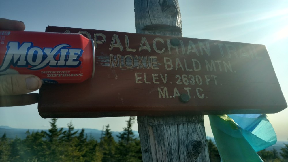
We climbed to the top of Moxie Bald Mountain first thing in the morning.
While not above treeline, it did have a large rocky area at the top. We had great views on all directions. We first looked to the north. Somewhere out there, hiding behind a mountain rage off on the horizon, was Mount Katahdin.


Moxie is also the name of a popular soda in Maine. A friend of mine used to rave about how much he loved the stuff. So, I picked up a can of the stuff back at the Sterling Inn, and brought it up to the top of the mountain.

Moxie Bald Mountain looked like a great place to fly a kite. As luck would have it, we knew someone who had one.
Everyone took a turn flying the kite. It felt like we were kids again. Goofing off in the woods with no real place to be.


We stayed up there for a while.
Ever since going through the Whites, we had planned shorter mileage days. One of the reasons we did that was because the terrain was so rugged. The other reason was that we didn’t want the hike to end. We already put in the effort. We paid our dues. We hiked through mud, rain, sleet ,hail, snow, ice, thunderstorms, frigid weather, hot weather, and 13 other states to get to here. Maine wasn’t just another state to get through, it was the reward for all the effort it took to get here. We were going to savoir and enjoy as much of the short time we had left on the trail as we could.

When we came down from Moxie Bald Mountain we stopped in at the Moxie Bald Mountain lean-to. The Lean-to was located right next to Bald Mountain Pond, and it was a great spot to stop for an early lunch.
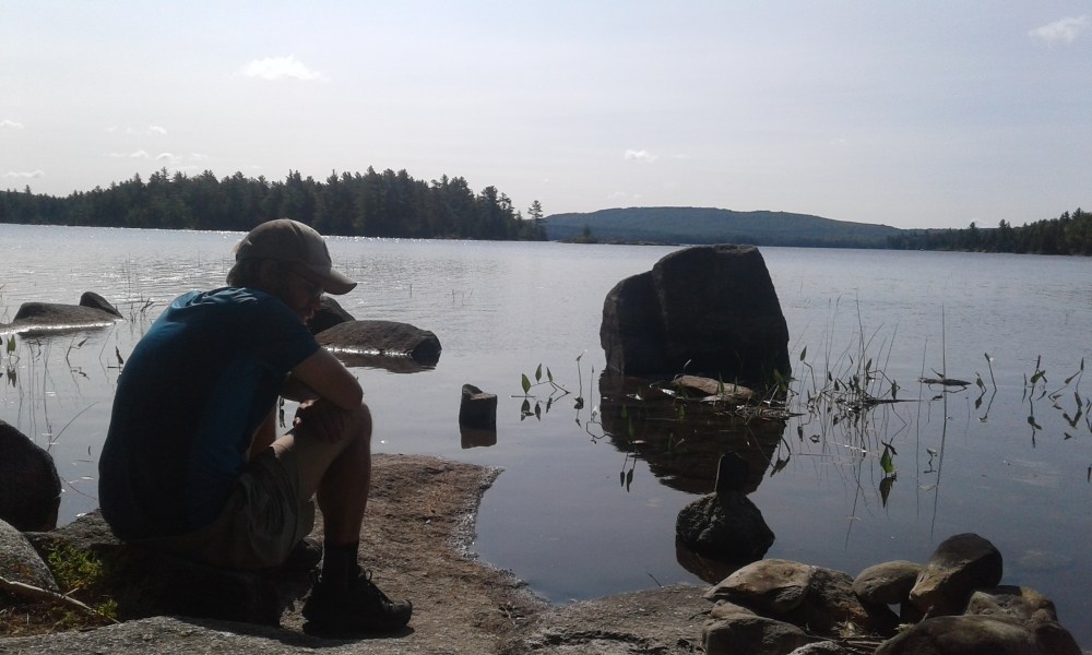
Flashfire went over to the edge of the pond to check it out. When she looked down at the water, she saw a caterpillar struggling to stay afloat. She found a stick and fished it out of the water. She placed it down on a rock, feeling very good about her good deed. Before she could do anything else, a frog came out of nowhere and quickly gulped down the caterpillar. “Noooo!”, she shouted, and then broke out into laughter. 
Two miles after leaving the shelter, we came to Bald Mountain stream. The Stream was supposed to be one of several streams/ rivers that we would have to ford. Fording streams in Maine is a Thru hiking tradition, and we were looking forward to it.
The Bald Mountain Stream crossing was disappointing. We crossed it without even getting our feet wet. That wasn’t too unexpected though, Maine was in a drought.
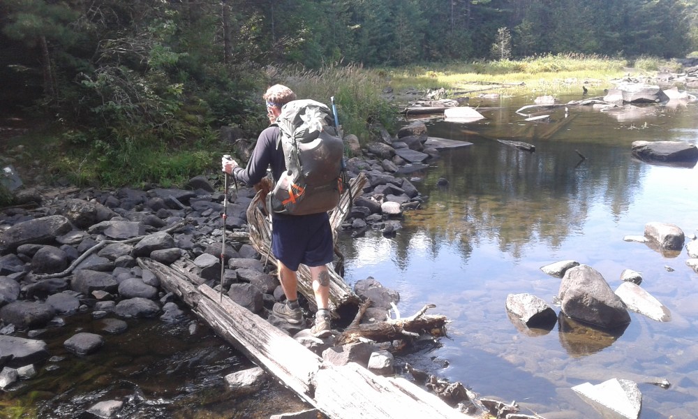
Four miles later we came to the west branch of the Piscataquis river. The guidebook said that the river was usually knee deep and advised caution.
When we got there, we stopped and took a snack break. We sat on the exposed river rocks that usually spent their lives underwater. Skunked again.
After the snack break, we crossed the river, again without getting our feet wet.
While it was nice not to get soaked crossing a river, we felt like we were being robbed of one of the quintessential AT experiences.
After crossing the river, the trail led us into a canyon that was carved by the Piscataquis river. The trail undulated a lot more than the guidebook led us to believe. We would go up a 50 – 60 foot hill, and then back down that same hill. Then up a 50 – 60 foot hill, and then back down that same hill. That went on for that next three miles.
When we got to the Horseshoe shelter, we were a lot more tired than we thought we were going to be.
A park ranger stopped in to talk to us. I can’t remember the last time that happened. She gave us the rundown of what we had to do when we get to the town of Monson tomorrow. There was an Appalachian visitors center in town. The most important thing we had to do when we went there, was to reserve a campsite in Baxter state park. (more on that in tomorrows post)
Also at the Horseshoe Shelter, were Sierra Mist and Sleepy Bear. They were doing a flip flop hike. Meaning that once they got to Katahdin, they would get a ride back to the middle of the AT and hike south. Ending their hike on Springer Mountain in Georgia.
You wouldn’t think, that after hiking over 2000 miles, the Tramily would be jealous of hikers that still had 1000 mile left to hike….but we were.
123.5 miles to go.
____________________________________
